 |
| ...More Topics... |
 Books Books |
 Bulletin Board Bulletin Board |
 Clubs & Huts Clubs & Huts- AMC Huts |
 Feedback Feedback |
 4,000 footers 4,000 footers |
 Hiking Glossary Hiking Glossary |
 Mail List Mail List |
 Privacy Policy Privacy Policy |
 Store Store |
 Weather Weather |
| Search |
|
|


Mt. Cabot Trail to the Kilkenny Trail
Things were not going particularly well in life (I got laid off) so I thought the best way to regain composure and improve my general attitude was to hit a new 4,000 footer and post a trip report.
The weather was due to be gorgeous, so I contacted Dome (who was on vacation) and we made plans to hit Mt. Cabot, a mountain I have wanted to hit for some time, mostly because it is too far north for most idiots to drive. Dome was up for the trip, so we made the plans and headed north!
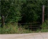
The Mt. Cabot trail is fairly easy to get to, but you should be paying attention. One you leave Route 2 in Jefferson, NH you follow gradually lower quality roads until you hit the trail head (see the White Mountain Guide for directions). As you approach "Heath's Gate", you notice that you're really on a road that belongs to two homes. Despite what the Guide says, there is no sign that indicates the trail junction, so you have to use your noodle and figure out that this is the right gate. It's next to a beautiful house with a train track in the front yard, and a business called Straight Edge Woodworking (I stopped in to see if anyone is there, but no luck).
Because of the proximity to these two homes, one should take great care to park responsibly. There is a small parking area about 100 feet from the gate and that should serve everyone who needs it. Otherwise there is a ditch that could also serve as an appropriate parking place (for big manly trucks like mine).
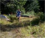
So by the time Dome and I hit Dunkin Donuts, got our asses up to the trail, and prepared to go, it was about 9:30 AM. We passed through Heath's Gate and ventured on up the old logging road (or current logging/rec. vehicle road). The grade is very smooth and easy for the first ½ mile or so. Consistent use by four wheeled vehicles made for a nice walk, even side-by-side. At about ½ mile, there is a junction at which one may proceed straight, turn left, or turn right. All options include a gate, but it is fairly obvious that the Mt. Cabot trail continues straight, considering there is no signage to indicate where to go. In fact, there is no signage AT ALL to this point, and as we found, there wasn't to be any until we reached the junction of the Bunnell Trail. This junction is where we believe the York Pond Trail begins, but again, a lack of signage makes us wonder.
After the initial ½ mile, the Mt. Cabot trail becomes a little more steep, although steady. The "road" ends at about 1 mile, where the logging seems to have stopped. There is a large clearing that looks as if it may lead to somewhere, but rest assured it does not.
From here the trail narrows, in some places significantly. The trekking becomes somewhat more difficult, as the footing is loose and rocks and tree roots grab at your feet. At about 2.2 miles, there is a small stream (Bunnell Brook, which was quite low) and the first signage that lets you know you're actually on the Mt. Cabot trail. This is the best and perhaps only spot to refill your water bottles, so keep this in mind.
The Bunnell Trail abuts the Mt. Cabot Trail here, so a detour is easy. But we decided to ride the Mt. Cabot trail all the way up to the top, so off we went. Here the trail gets so narrow that it is almost non-existent, but you can still follow it. The grade gets steeper and you may notice that it took you about an hour to get to this point. Don't be fooled, it will take you twice that to get to the summit from here!
As you move toward the junction of the Kilkenny Trail, there is little to note about the hike except that it is a typical 4,000 footer trail: rocky, fairly steep, and unforgiving. Watch your step and things will be fine.
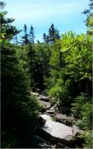
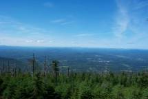
At about 3.0 miles, you get your first views, which were spectacular. The trail gives you little tastes of what is to come, albeit through trees. Things get a little more rocky, but it's not too bad. If you take the time to look, at one of the switchbacks there is a very clear delineation of Birch and Evergreen trees that looks rather funny when you stop and check it out. One side of the trail is all Birch, the other all evergreen.
After the great views, we were charged up to get to the summit, but not before we got to the Cabot Cabin. You get rewarded at about 3.5 miles, where the Forest Service (NOT the AMC) has a small hut that can be used for lodging. The views from the cabin are awesome, and it is worth
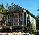 spending a little time there. There is no potable water here, so don't count on it. There is a sign that indicates water is 900 feet away, but keep in mind that during dry periods, this may not be the case.
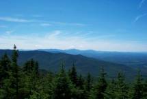
As the trail continues on, the best view on the trip presents itself about 100 feet away from the cabin. Views can be had from two directions and there is plenty of room to eat lunch or just soak in some rays. Once you get tired of this, the trail to the summit is easy to follow. Just continue in the same direction and in about 5 minutes you reach the summit of Mt. Cabot. For us, the trip took about 3 hours from Heath's Gate, and we were taking our time.
The summit provides no views, as it is completely occluded. There is a small sign to indicate the peak, but other than that, what you see is what you get! Since the summit was blind, we turned tail and headed back towards the cabin. A quick lunch and we were ready to head back down.
We left the summit at about 2:00 PM and returned the way we came. The trip back down was naturally much faster than the way up, but we made it down in about 90 minutes.

Chris Oberg & Robert Havasy
Hike-NH.com


