 |
| ...More Topics... |
 Books Books |
 Bulletin Board Bulletin Board |
 Clubs & Huts Clubs & Huts- AMC Huts |
 Feedback Feedback |
 4,000 footers 4,000 footers |
 Hiking Glossary Hiking Glossary |
 Mail List Mail List |
 Privacy Policy Privacy Policy |
 Store Store |
 Weather Weather |
| Search |
|
|


Nancy Pond Trail to Nancy and Norcross Ponds
The hiking season of 2000 proved to be a slow one for us. We seemed unable to find the time to do many hikes. This is not a good thing when you are trying to be the webmasters of a hiking related website. As the summer turned into fall, we found a free weekend day. Not an entire weekend, but one day. It would have to do.
The criteria for this hike were the following:
- Must be a loop, hikable in about six hours
- Should not require a tremendous amount of climbing (we wanted to enjoy the views)
- Should provide some good scenery along the way
Luckily, a hike that meets these criteria is almost always easy to find in the White Mountains. A quick glance through some suggested hikes in the White Mountain Guide and we had a plan: We would hike to Nancy and Norcross ponds via the Nancy Pond Trail. The Guide promised the ponds would offer great scenery, including what it described as one of the best views of the Pemigewasset Wilderness (viewed from the rock ledge that forms the natural dam at the north end of Norcross Pond). The hike sounded too good to pass up, especially since the entire trip was about eight miles in length and the climbing didn't sound too strenuous. The plan was set and we left home at 8 AM on Sunday, October 1, 2000.
We zipped up Rt. 16 (the Spaulding Turnpike) and bailed off on the Kanc in order to take Bear Notch Road around the mess in Conway and pop out on Rt. 302 (pretty close to where we needed to be). The trailhead for the Nancy Brook Trail is well marked on the left side of Rt. 302 (heading West) just before you reach Notchland. The parking area is directly to the side of the road and has room for about six cars (as long as certain people from a state to remain nameless don't try and leave an extra 18 feet between their precious SUV and the car next to them). Don't worry, there appears to be parking parallel to the road at either end of the little lot and a large amount of space across the road.
We started up the trail at about 10:45 AM. The trail begins on what appears to be the remnants of an old logging road. It begins climbing at a moderate grade, but is very clear and easy to follow. Two people can walk side-by-side for about the first 3/4 to one mile of the trail. As the trail winds it's way through the woods, it passes some houses very near the trail, which highlights the fact that the trail doesn't actually enter the White Mountain National Forest until after the first mile. The boundary is marked by red paint on trees and a large pile of red rocks at a corner.

Throughout most of its length, the trail is very easy to follow. It is blazed with yellow along nearly its entire length, but there is a section in the middle where the blazes disappear. You should have no trouble following the trail, however. Throughout the first two miles, the trail crosses a couple of small brooks. These crossings should pose no problem, but the guide mentions they might be difficult in times of high runoff. This is certainly something to keep in mind.
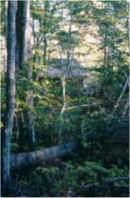
About two miles into the hike, we came upon an odd structure to the left side of the trail that we assumed to be some kind of spring house. However, the White Mountain Guide identifies it as the remains of the "Lucy Mill." It gives no indication of what they actually used to mill. From this point on, the trail narrows and becomes typical of most single-track White Mountain trails: It climbs steadily for most of its length, with one very steep section in the middle. While we originally selected this hike as an easy-to-moderate one, our assessment changed once we actually experienced the trail. The hike gains about 2000 feet over its 4-mile length, which qualifies as a generous elevation gain and is comparable to that gained when climbing many of the 4000 footers. However, for about 3.5 of the 4 miles, the gain is slow and steady. (We'll cover the other .5 miles in the next few paragraphs.)
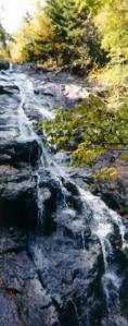
About 2.5 miles from the trailhead, we came upon the Nancy Cascades. The guidebook had indicated this, but it couldn't prepare us for how incredible the sight was. The Nancy Cascades is exactly what you expect a waterfall to be: A clear stream tumbling over a sheer rock face into a pool at the bottom. Although not quite as high as Arethusa Falls, I rank these as some of the most beautiful in the Whites. It's worth the effort just to see these falls.
Now think about what I just wrote for a second. Water cascading over a sheer rock face. That means cliff. A cliff is a steep rock face. That means that the terrain surrounding the cliff is probably steep also. And, in fact, it is. Once you reach the base of the falls, be prepared for about a 1/2 mile of steep climbing up some switchbacks. I will say that this climb was kind of strenuous -- this trail would make a perfect training run prior to tackling a 4000-footer. This section near the falls was as steep as many "taller" trails we have hiked.
Once you reach the top of this trail section, you are treated to great views of the top of the falls and of the valley below. From here to the ponds, the trail follows mostly flat terrain and isn't very remarkable. The trail is still well marked, but it travels through some swampy areas. There are some improvements on the trail, such as some old log "bridges" over the muddiest parts, but it appears that this trail has been neglected for some time; most are in bad shape, though they held our big butts up, so they must be sturdy.
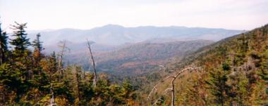
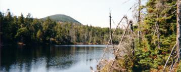
After hiking for another mile, we were treated to an opening in the trees and our first views of Nancy Pond. It was incredible … we'll let the photos speak for themselves. We stopped and admired the pond for a while, then pushed through the last 1/2 mile to Norcross ponds. All we can say is that as beautiful as Nancy Pond was, it couldn't prepare us for what we saw at Norcross. We hiked all the way to the north end of the pond and ate our lunch on the ledge described in the White Mountain Guide. There was no one around, the pond was smooth as glass, and the view into the Pemigewasset Wilderness was better than the book described.
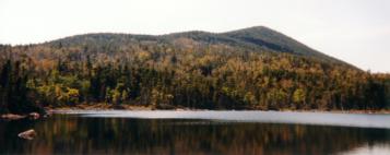
We took in the views for about an hour, then packed up our stuff for the hike out. We retraced our steps back past Nancy Pond and the Cascades, and arrived back at the parking area around 4:30, just shy of our 6 hour target.
Overall, this was probably one of the best hikes we have taken. The views are better than almost anything we have seen from the summits of any of the 4000-footers and the hike was the perfect balance of steep and flat. It challenged us enough to make it all worthwhile, but left us strong enough to really enjoy the sights.
For the record, we highly recommend this hike. It's moderately challenging, but not so much that you can't bring the kids along. It's gorgeous, with views pretty much throughout the entire hike (some of which we'd stack up against any in the WMNF). And above all, it's easily hiked in one day, so if you only have a few hours, you can still enjoy it.
Chris Oberg & Robert Havasy
Hike-NH.com


